Kenosha Reuse Discussion Board > SOMERS, WI
> Commercial
> Topographic surveying geodetic training course book cd
Topographic surveying geodetic training course book cd
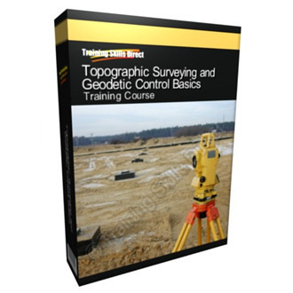
Topographic Surveying and Geodetic Control Basics Training Course CD
Topographic Surveying and Geodetic Control Basics Training Course brought to you by Training Skills Direct.
Training Manual 1 - Photogrammetric Mapping (373 Pages)
Chapter 2 - Photogrammetric Accuracy Standards and Classifications
Chapter 3 - Photogrammetric Processes
Chapter 4 - Photogrammetric Mapping Planning and Cost Estimating Principles
Chapter 5 - Aerial Photography
Chapter 6 - Ground Control Requirements for Photogrammetric Mapping
Chapter 7 - Airbourne Global Positioning System Techniques
Chapter 8 - Analytical Aerotriangulation
Chapter 9 - Stereocompilation Procedures
Chapter 11 - Airbourne LIDAR Topographic Surveying
Training Manual 2 - Survey Markers and Monumentation (54 Pages)
Chapter 3 - Vertical Control - Bench Marks
Chapter 4 - Horizontal Control Monuments
Chapter 5 - Boundary Monuments
Training Manual 3 - GPS Surveying (469 Pages)
Chapter 2 - Operational Theory of GPS
Chapter 4 - GPS Absolute Point Positioning Determination Concepts, Errors and Accuracies
Chapter 5 - Differential or Relative Positioning Determination Concepts
Chapter 8 - Planning Collection with GPS
Training Manual 4 - Geodetic and Control Surveying (101 Pages)
Chapter 2 - Control Surveying Applications
Chapter 3 - Standards and Specifications for Control Surveying
Chapter 4 - Reference Systems and Datum Transformations
Chapter 5 - Horizontal Control Survey Techniques
Chapter 6 - Vertical Control Survey Techniques
Chapter 7 - Miscellaneous Field Notekeeping and Procedural Requirements
Training Manual 5 - Control and Topographic Surveying (498 Pages)
Chapter 2 - Overview of Topographic Surveying Techniques and Methods
Chapter 3 - Primary Control Surveys for Project Mapping
Chapter 4 - Accuracy Standards
Chapter 5 - Geodetic Reference Datums and Local Coordinate Systems
Chapter 6 - Planning and Conducting Control and Topographic Surveys
Chapter 7 - Field Data Collectors and Coordinate Geometry Functions
Chapter 8 - Total Station Topographic Survey Procedures
Chapter 9 - GPS Real Time Kinematic Topographic Survey Procedures
Chapter 10 - Terrestial 3D Laser Scanners
Chapter 11 - Final Site Plan or Map Production
Chapter 12 - Survey Documentation and Submittals
Chapter 13 - Topographic Survey Contracting and Cost Estimating
Training Manual 6 - Structural Deformation Surveying (289 Pages)
Chapter 2 - Planning, Design and Accuracy Requirements
Chapter 3 - Deformation Measurement and Alignment Instrumentation
Chapter 4 - Sources of Measurement Error and Instrument Calibrations
Chapter 5 - Angle and Distance Observations-Theodolites, Total Stations and EDM
Chapter 6 - Settlement Surveys-Precise Differential Leveling Observations
Chapter 7 - Alignment, Deflection and Crack Measurement Surveys-Micrometer Observations
Chapter 8 - Monitoring Structural Deformations Using the Global Positioning System
Chapter 9 - Preanalysis and Network Adjustment
Chapter 10 - Relative Distance Ratio Assessment Methods
Chapter 11 - Analysis and Assessment of Results
Chapter 12 - Data Presentation and Final Reports

